Add locations to filenames from GPS coordinates
Let RenamerX use GPS coordinates saved in a file to add a city, district, region, or country to its filename.
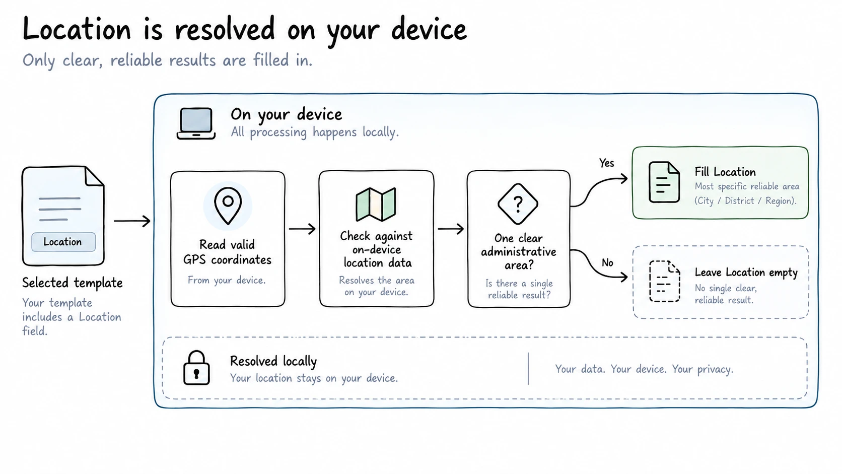
When your template includes Location, RenamerX converts GPS coordinates in the file's metadata into a readable place name. This happens automatically on your device, with no separate setting to enable. RenamerX does not send the coordinates to AI or an online map service.
Understand the location added to the filename
RenamerX adds the most specific place name it can identify reliably. Depending on the available data, the result can be a city, district, region, or country.
The Location field contains one place name: the smallest administrative area RenamerX can identify. It does not list every matched city, district, region, and country in the filename.
Use Location in a filename
Location lookup runs only when the selected template includes Location:
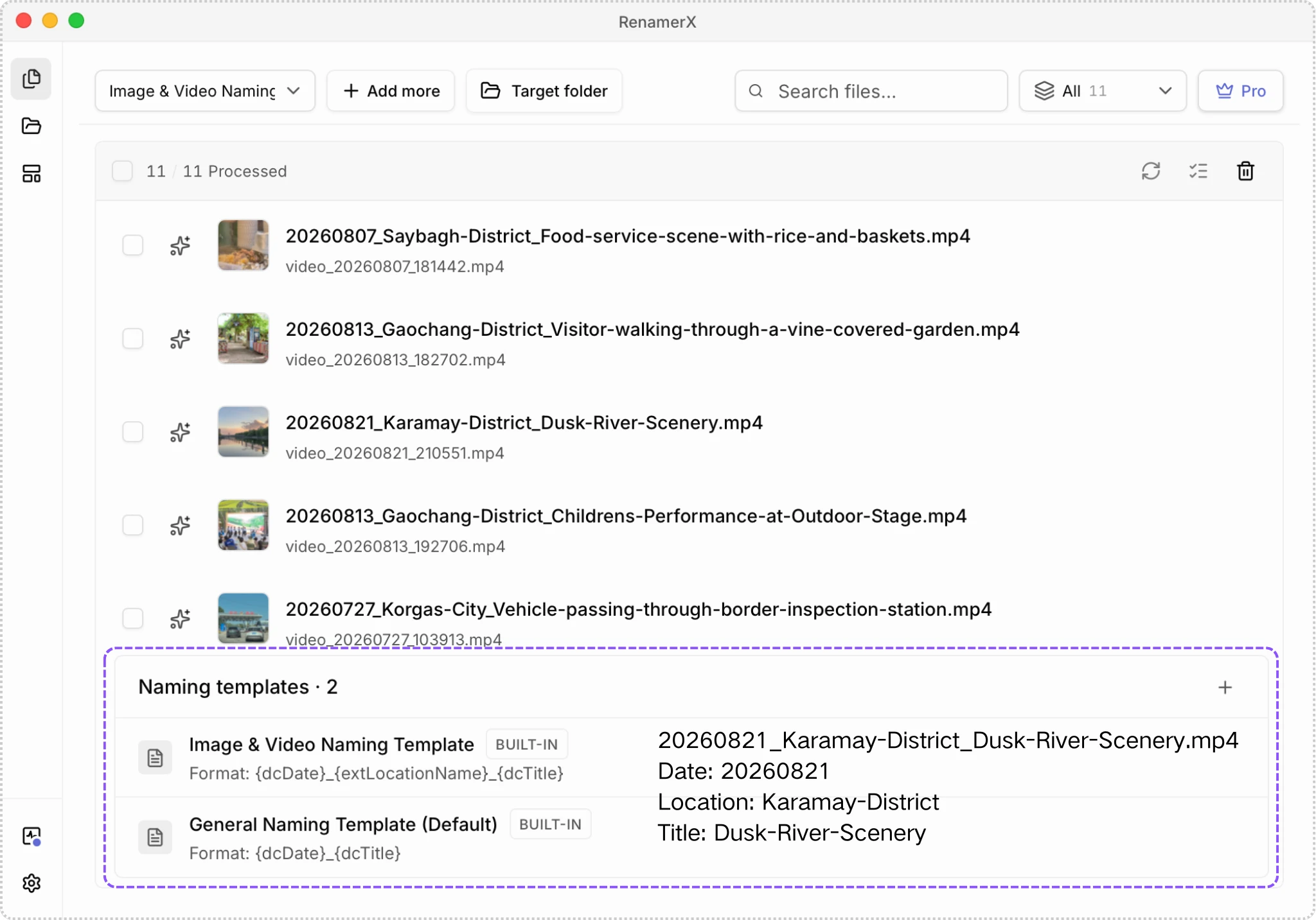
- Select a template that includes Location. For example, the built-in Image & Video Naming Template uses
{Date}_{Location}_{Title}. - Add a file that contains valid GPS coordinates.
- Wait for RenamerX to generate a suggested filename.
- Review the location and the rest of the filename before applying changes.
Understand why Location can be empty
RenamerX leaves Location empty in any of these cases:
- The selected template does not include Location
- The file does not contain valid GPS coordinates
- The installed location data does not cover the coordinates
- More than one location matches and RenamerX cannot choose one reliably
- The required location data is unavailable or cannot be read
RenamerX does not guess a nearby place when it cannot identify one reliable result. If a file should contain GPS coordinates but Location stays empty, check the file in a photo or metadata app that can display GPS information.
Keep GPS coordinates on your device
Location matching uses data installed as part of RenamerX's required resources. An existing installation may need to download new resources after an update.
RenamerX keeps GPS coordinates separate from the information sent to AI. It matches the coordinates after AI processing and does not send them to an online map service or the active AI Provider.
If you use an external AI Provider, RenamerX can still send other file content and metadata to that service. See AI Providers for details.